St Albans – school admissions
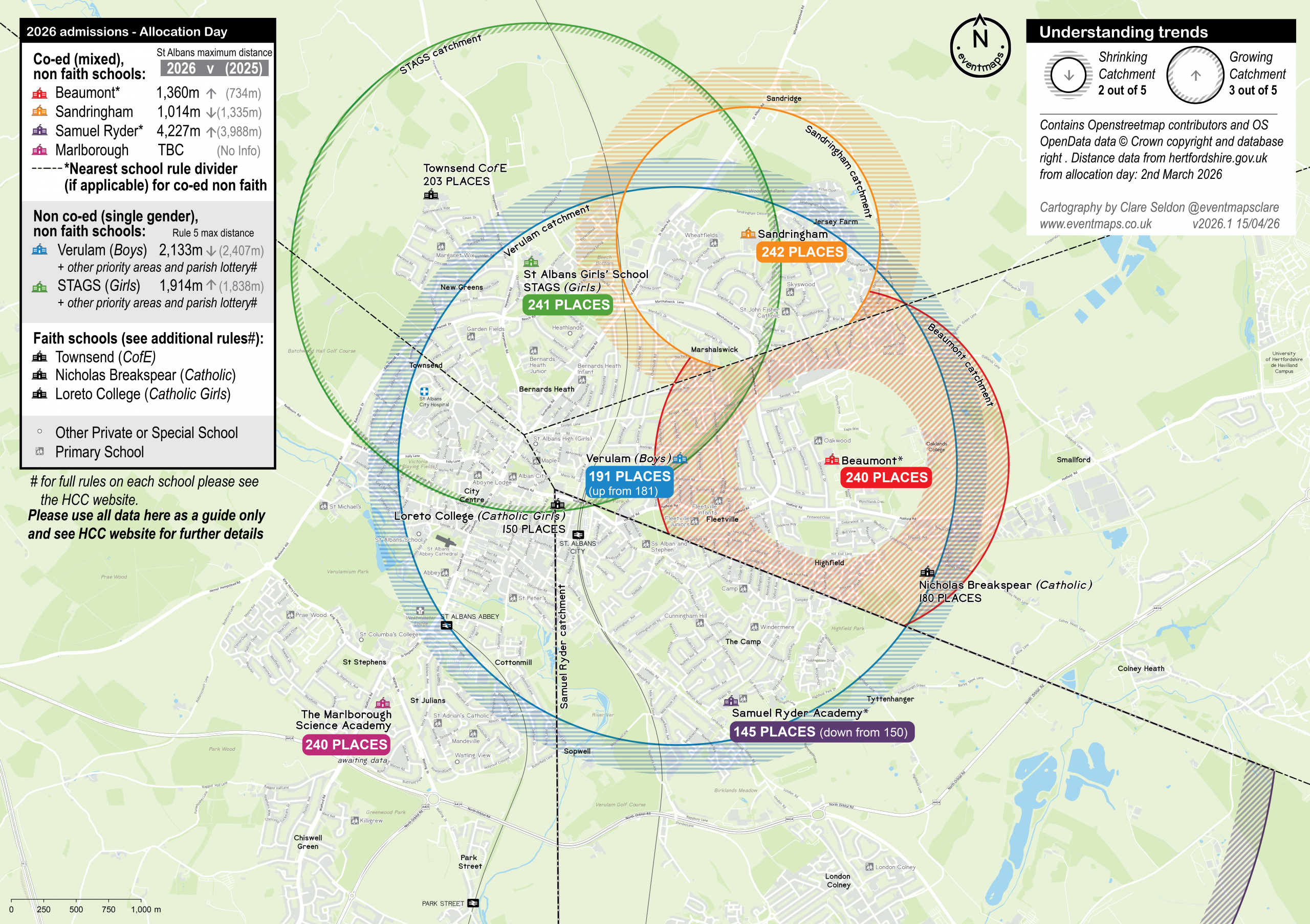
This map aims to help visualise the nature of school catchments in the local context.
It was devised to help local families understand the potential limitations of their choices for secondary education and variation of rules for each school. Please only use this in conjunction with the HCC website on your nearest school rule and other rules for each school, which could include for example; faith, gender, or parish lottery places.
Please note these maps are drawn at a smaller scale than the distances HCC or the schools calculate. If you live close to a dividing line or circle edge please check which side you fall on as it could be different to that shown. Please only use this as a guide. Find your nearest HCC school
Note that outer rings show a shrinking catchment from the previous year, and inner shaded rings show the extent of any growth. You can see previous years’ statistics on the HCC website: HCC previous stats
Where circles are sliced up the nearest school rule divider has been used to divide it.
Previous maps are available as PDFs for context below:
2025 Admission Day and Continued Interest Round 1 map
2024 Admission Day and Continued Interest Round 1 map
2024 admissions map